Cycladic Plumbing at Akrotiri
Cycladic Toilets, Drains, and Water Pipes
Akrotiri or
Ακρωτήρι
is a prehistoric settlement of the
Cycladic culture
along the southern shore of
Thira or
Θήρα,
commonly called Santorini or
Σαντορίνη,
the southernmost of the Cycladic islands in the Aegean sea.
The settlement was abandoned shortly before the
catastrophic Thira eruption,
now thought to have happened around 1600 BCE.
Akrotiri was a Neolithic settlement in the fifth millennium
BCE, a small fishing and farming village.
While Akrotiri was influenced by the concurrent
Minoan
civilization based in Crete, 120 kilometers
to the south, it definitely was part of the
Cycladic culture that arose around 3200 BCE
and lasted until about 1050 BCE.
Akrotiri had developed and expanded significantly by the
late 2000s BCE, with a busy commercial port and a
population estimated at 5,000 to 6,000
around its peak around 1800 BCE.
It was on the sailing route between Cyprus and Minoan Crete,
and it had become an important copper processing center.
Thira is the caldera of a large volcano.
Explosive eruptions through the millennia have built
up many layers, and left a partial ring around the
central caldera.
Akrotiri is near the southwest tip of the C-shaped
largest island, Thira.
Thirasia, the second-largest island is also inhabited.
The small islands near the center are
Palea Kameni and Nea Kameni,
the Old and New Burned Islands.
They're the newly forming volcanic islands,
first appearing between 197 BCE and 47 CE.
Ready for cataclysmic explosion in, maybe, any time now.
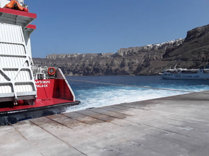
As you arrive by ferry at the port in the caldera, you see the modern settlements along the caldera rim above many layers of rock and tephra.
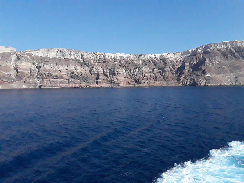
You see the multi-colored rock and tephra layers while crossing the Santorini caldera on a ferry.
Oia, the second-largest town, is at the northwest end of the main island.
The Eruption and Ash
The catastrophic eruption, thought to be the most violent explosion since the development of modern humans, ejected about 60 cubic kilometers of dense rock, shattered and powdered into about 100 cubic kilometers of tephra. The eruption column would have reached the stratosphere, 30 to 35 kilometers above the sea.
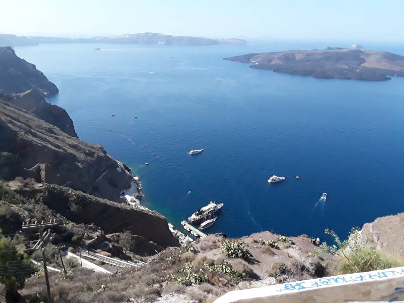
Palea Kameni and Nea Kameni in the center of the caldera, as seen from Fira, the main town.
The eruption laid a 60-meter layer of white tephra across Thira. The island of Anafi, 27 kilometers to the east, got a three-meter ash layer. Cores drilled from lakes in Turkey and the Aegean seabed show that the heaviest ash deposits fell to the east and northeast.
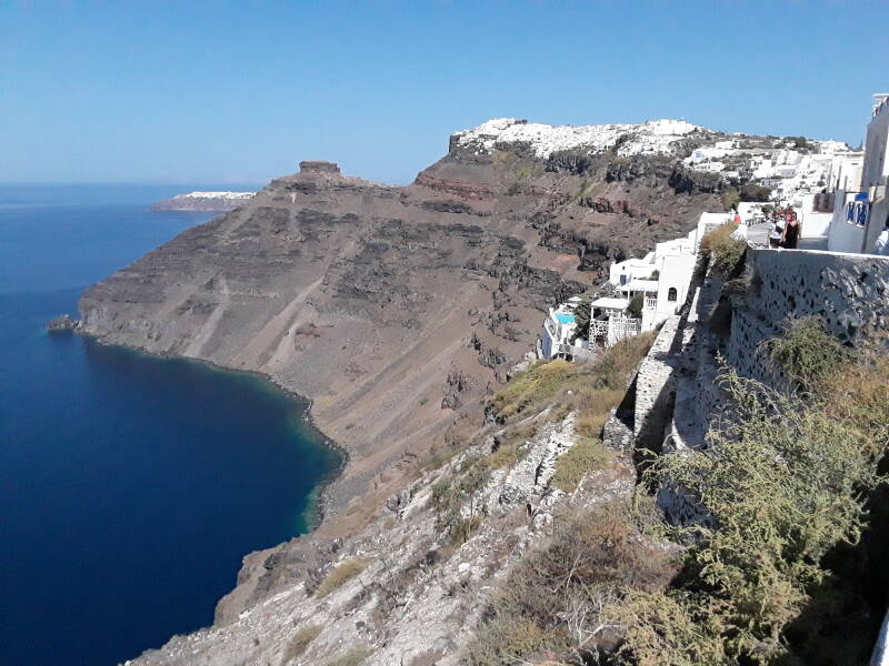
Layers of rock and tephra below the caldera rim in Santorini.
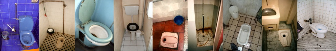
Toilets
There has been a theory that large ash deposits to the source brought on the collapse of the Minoan civilization on Crete. However, more recent studies have shown that locations across Crete received no more than 5 millimeters of ash. A tsunami generated by the blast could have been very damaging to Minoan sites right on the northern coast of Crete, like Malia and Amnisos. However, Knossos is over five kilometers inland and at about 100 meters elevation above sea level, while Phaistos and Gortyn are over the high central ridge of Crete, near its south shore.
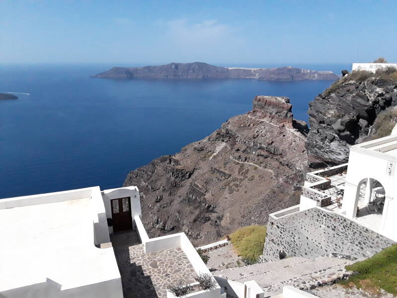
The smaller inhabited island of Thirasia is in the distance beyond layers of rock and tephra below the caldera rim.
Another theory has been that there was heavy ash fall in the Nile delta, and that some of the events described in Exodus might have been caused by the Thira eruption. The explosion could have been heard in Egypt, and the stratospheric effects could have been seen, but there wouldn't have been any multi-day column of fire and smoke, parting of the sea, plague of toads, or so on.
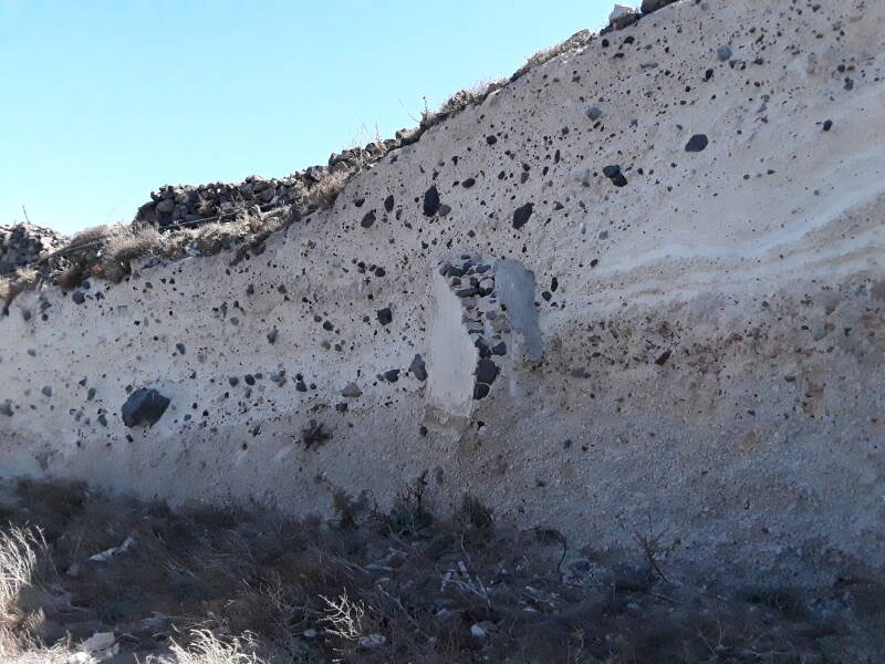
White tephra, largely white tufa with black stones embedded in it.
Archaeologists comparing pottery styles with those of Egypt and the Levant have traditionally dated the Thira eruption at approximately 1500 BCE. However, radiocarbon dating using samples like an olive branch buried beneath a lava flow yields dates of 1627–1600 BCE.
Ice cores from Greenland show evidence of a large volcanic eruption a little earlier, around 1642 ±5 BCE. But the microscopic glass shards found in those cores do not match the chemical makeup of Thira, and are thought to have been from a smaller eruption of Aniakchak in Alaska.
Dendrochronology or tree-ring dating shows that some large event interfered with normal tree growth in North America, Ireland, England, Germany, and Sweden around 1629–1628 BCE. The Bamboo Annals of China record that the collapse of the semi-legendary Xia dynasty and the rise of the Shang dynasty, around approximately 1618 BCE, were accompanied by "yellow fog, a dim sun, then three suns, frost in July, famine, and the withering of all five cereals." The "three suns" would be references to "sun dogs" or parhelia, optical phenomena caused by tiny ice particles in the upper atmosphere, possibly formed around high-altitude volcanic dust.
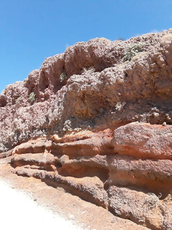
A layer of red deposits near the caldera rim.
of Pompeii
Akrotiri got a heavy layer of ash. Then the eruption was followed by rainstorms that made a liquified mud of the ash, flowing down to fill the structures and preserve and protect them much like Pompeii.
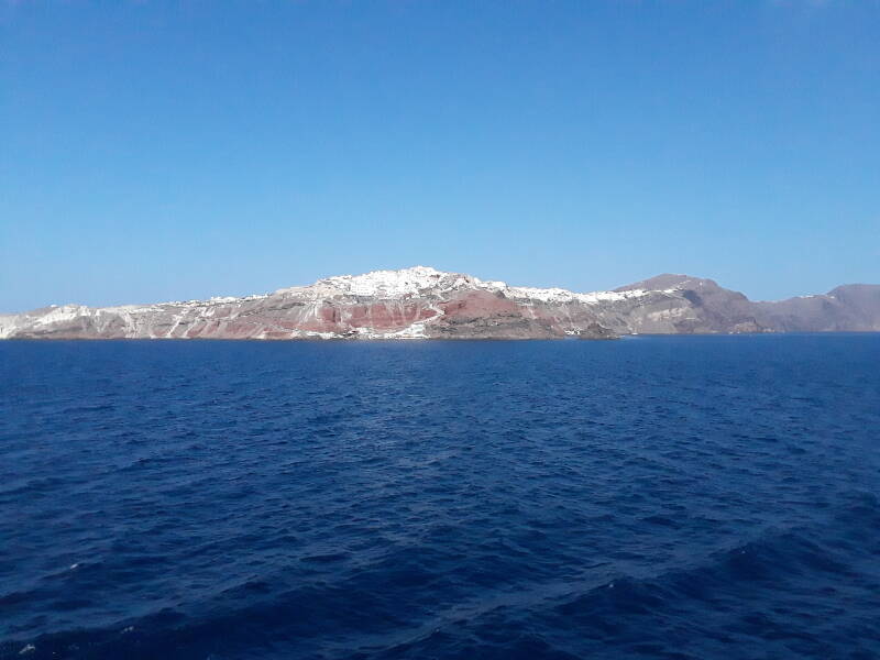
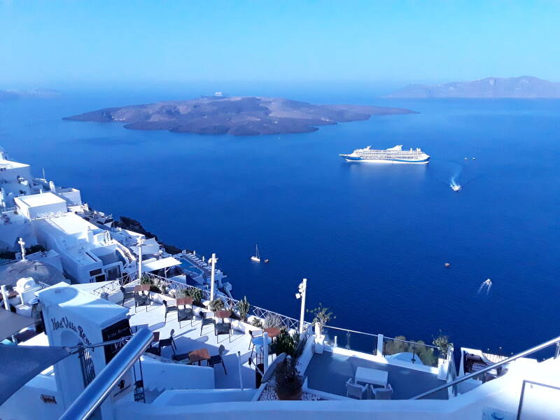
The main town is Fira, on the edge of the caldera rim. It's near the center of the "C" formed by the main island. In the background beyond Fira is Mount Profitis Ilias, the highest point in the archipelago at 567 meters above the sea.
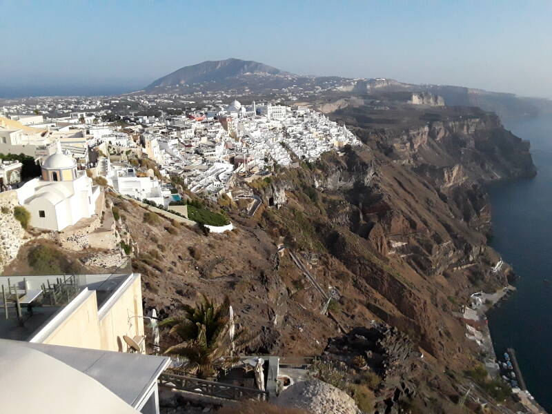
Santorini is an extremely popular destination, with huge cruise ships constantly making short visits.
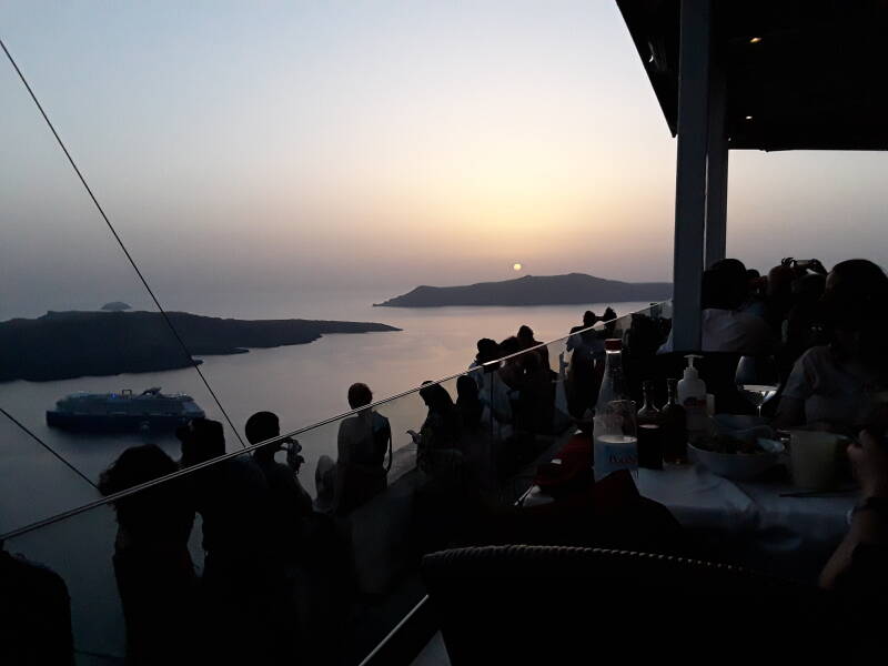
For the cruise ship visitors it's all about strolling the narrow passageways, now lined with jewelry and souvenir shops in central Fira. Or deciding where to watch the sunset, if they get one evening on shore.
Let's visit Akrotiri! Prehistory! Drains!
Visiting Akrotiri
The ruins of Akrotiri are just south of the modern village by the same name, just inland from some beaches including Κόκκινη Παραλία or Red Beach.
Take a bus from the station at the center of Fira to Akrotiri. The bus ticket is € 1.80. The bus from Fira stops along the way, and then in the village of Akrotiri, and after that it ends at the Akrotiri site and where you would start walking to the beach. In the below picture we're in Fira looking south to the modern village of Akrotiri, at the highest point in the distance.
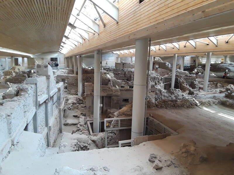
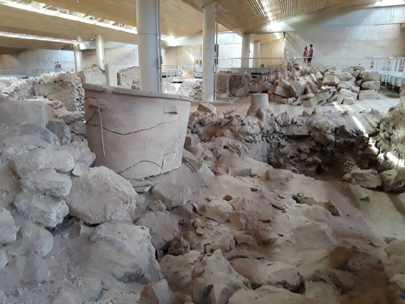
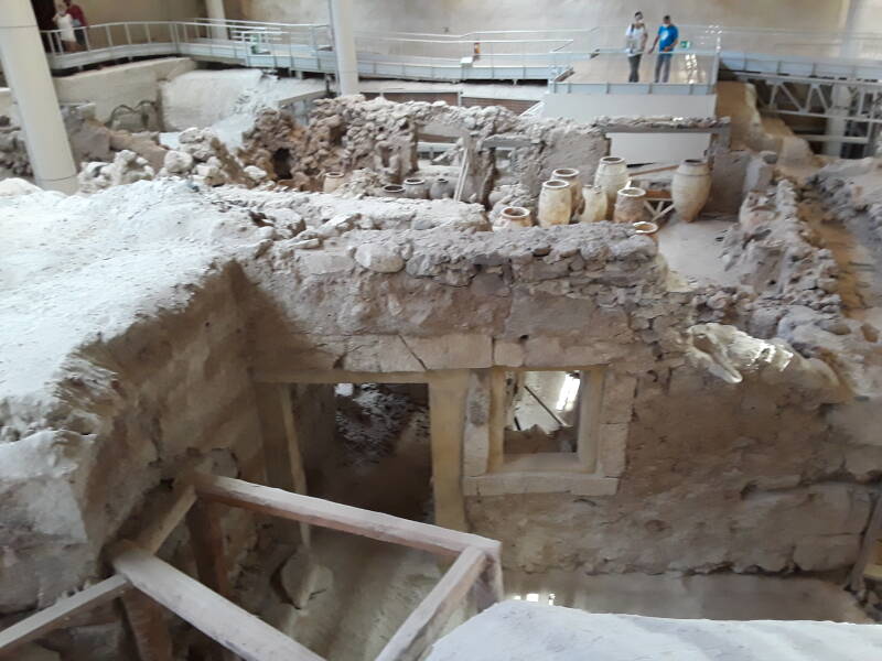
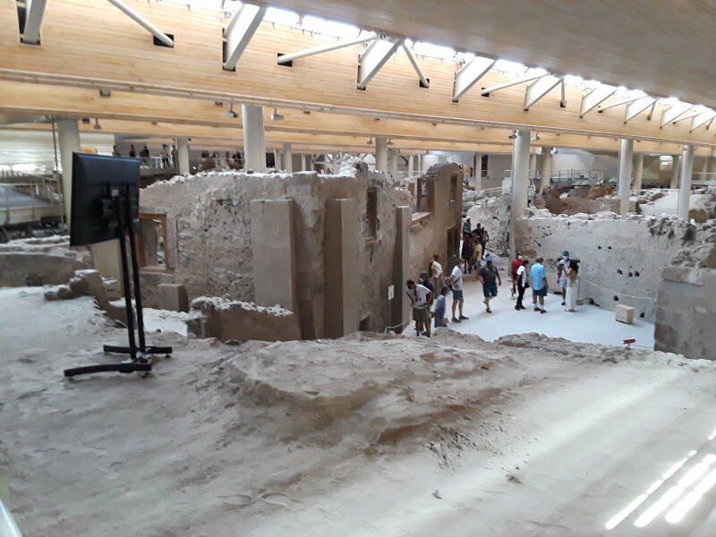
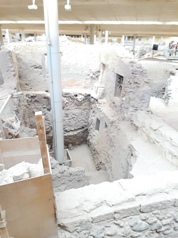
You buy your ticket and enter the site. The exposed area of the ancient settlement is completely enclosed, to protect the remaining tufa and mud bricks from further erosion or decay.
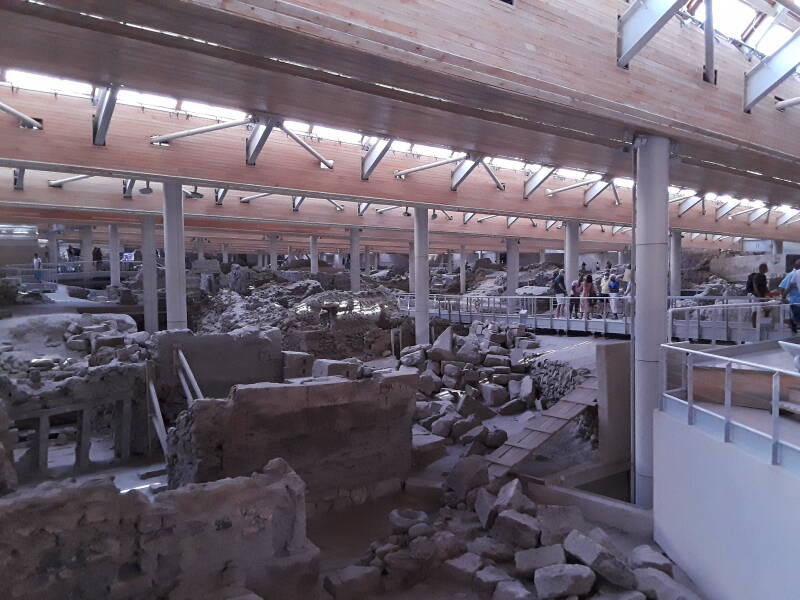
The homes and workshops were in buildings of two to three stories, lining narrow streets. As the archaeologists have slowly uncovered the structures, bracing has been added as needed. Concrete has been used in places, wooden bracing suffices in others.
They remove material as they excavate down through the layers. That's the nature of archaeology. It means that features like a once-famous latrine seat will be removed, to discover what was in the level below that at the time. And then that will be removed, to see what was at the site before the house was built.
An era is selected, and the rough outlines of structures standing at that time are left. Earlier layers are left buried. Rough structures remain, while their contents and interior decorations go to archaeological museums.
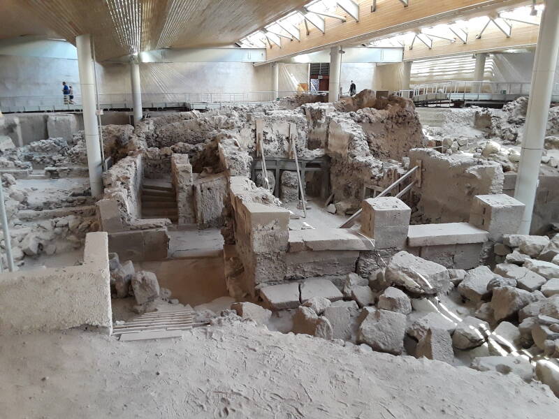
Deeper excavations have been made to place many of the support columns.
These deeper excavations have revealed earlier layers, going back to the original Neolithic settlement of the site.
And of course there are plumbing features. Here is a large bathtub found in one of the houses. This one is an actual bathtub.
They have also found several examples of a larnax or λάρναξ, a coffin used to hold skeletal remains. They might look similar but they aren't large enough to take a proper bath. Smaller objects, and most not-so-small ones, are taken away for preservation and study.
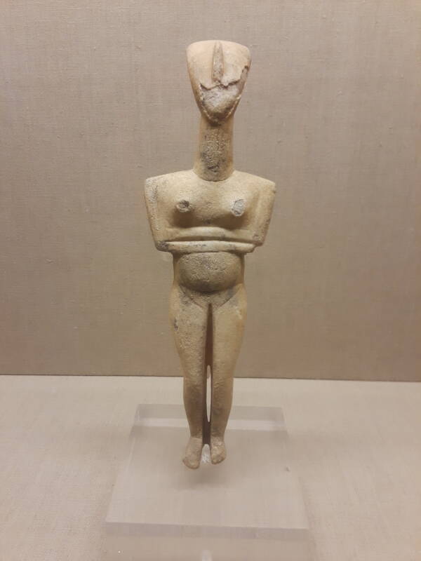
Smaller objects found on Thira include some marble Cycladic figures like this one, now in the museum at the center of Fira. It's from 2700–2300 BCE, the Early Cycladic II period. A Cycladic culture combining mainland Greek and Anatolian features appeared in the western Aegean some time before 4000 BCE. What's called the Early Cycladic period began around 3000 BCE. Akrotiri was in touch with the Minoan civilization on Crete, and goods and art and ideas flowed back and forth. But this was a Cycladic society, not a Minoan one.
Archaeologists have only found one small gold object at Akrotiri, and no human remains other than burials done well before the eruption. It seems that a series of earthquakes and smaller eruptions provided a strong advance warning, leading the people to pack their valuables and leave the site before the huge final cataclysm.
For the most part you look down into and across the site from a network of elevated walkways. There are directional arrows along the walkways. They're needed to manage the large crowds possible during high season.
I was there in mid September 2021 during the COVID-19 pandemic, so the crowds were pretty small. But I think the several attendants were being at least as strict as they ever were about enforcing the directional signs.
The problem is that the directional signs make it impossible to simply walk through and see everything. It seems that M. C. Escher designed the walkways and their directions. The situation is made worse by groups with hired guides who block the walkways and are allowed to go whichever way they want.
It's no problem: Just go around multiple times and take different turns at intersections to cover areas you haven't visited yet. Three nearly complete circuits plus a partial fourth took me through every publicly accessible point.
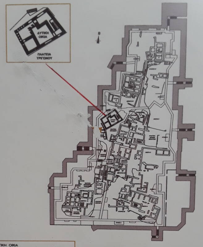
See the below map, north is at its top. ΟΔΟΣ or ODOS means "Street". The main north-south street through the southern half shows up clearly, some narrow side streets are labeled.
ΠΛΑΤΕΙΑ or PLATEIA means "Square".
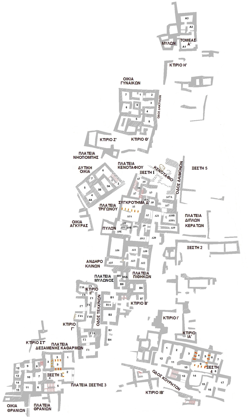
Map of Akrotiri from Wikipedia, created by user Klearchoskapoutsis.
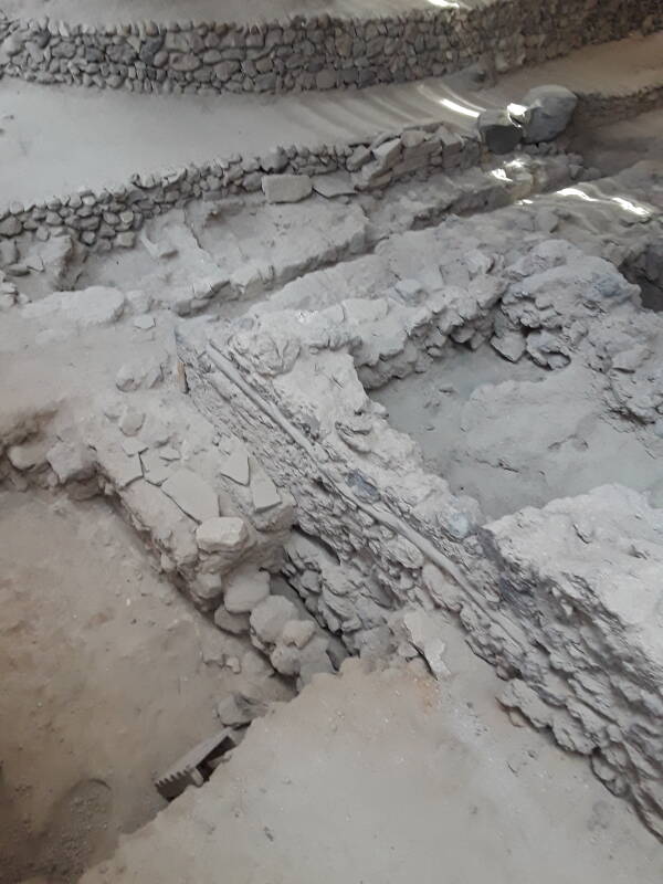
Below is a view to the north along the large central street. Just beyond the first column you see one of the many plumbing lines that ran beneath the streets of Akrotiri.
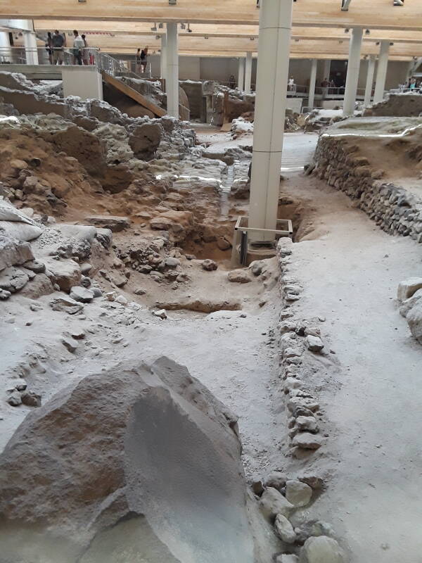
Houses were connected to the municipal water supply and drain lines running under the streets.
Minoan Plumbingat Knossos
The water supply lines, made of terracotta or clay, were somewhat similar to the water supply lines found at Knossos.
However, at Akrotiri there were two parallel systems of water supply lines. Archaeologists believe that this may have been to supply both hot and cold running water. There is plenty of thermal energy available in the vast Thira volcanic system. Water from a hot spring could be fed into one system, and water from a cold spring into another.
One of the hired guides was explaining the below house wall with a doorway, a window frame, and a marble feature to the upper right of the window. This combination is a Big Deal in archaeology.
For one thing, this is a very early example of a home with a door and a window. It's even more innovative by having the window right next to the door. Today that seems like a common design, no big deal, but that combination was actually an innovation around 2000–1800 BCE.
A structure had to have some type of door or passageway in order to get in and out. This structure's door, however, was a sophisticated one with stone blocks as a frame, and a swinging wooden panel to block and open the doorway.
Windows were a luxury in early housing structures, something not absolutely required, but a nice addition providing light and ventilation. This structure had a window right next to a doorway, both framed with stone blocks. This is Mid-Cycladic Ostentatious.
An even bigger reward for someone looking for toilets, drains, and other water-handling features is that marble feature above and to the right of the window. That's a rain gutter spout, designed to collect water from a roof and pour it out into the street to drain away, rather than running down the wall of the house. She said that it's the earliest rain gutter spout known to archaeologists. A proto-gargoyle, if you will.
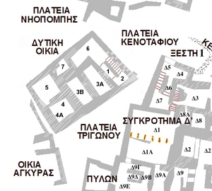
Now let's look at ΔΥΤΙΚΗ ΟΙΚΙΑ or "Western House". It is surrounded by three squares, including ΠΛΑΤΕΙΑ ΚΕΝΟΤΑΦΙΟΥ or "Cenotaph Square" to its northeast, and ΠΛΑΤΕΙΑ ΤΡΙΓΩΝΟΥ or "Triangle Square" to its southeast.
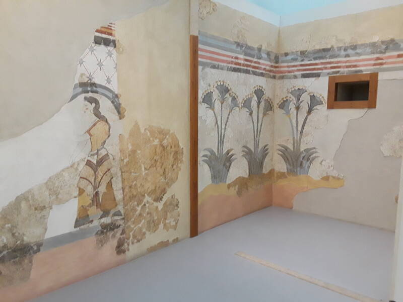
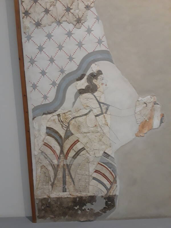
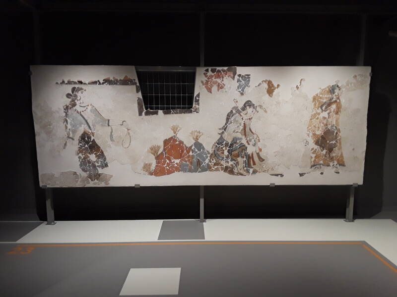
Notice its rooms 4, 4A, and 5. Rooms 4 and 5 were decorated with frescos, which were protected by the tephra. The frescos have been removed, taken to the archaeological museum in Fira for conservation and on display there. Room 4 was subdivided with two thin walls, forming a small rectangular space designated 4A in the south corner and leaving the rest of 4 as an L-shaped space.
Room 4A famously housed the flushing latrine of Akrotiri. Let's take a look!
Cenotaph Square and Triangle Square have been covered in concrete. You can descend from the elevated walkway into Cenotaph Square, walk halfway around the Western House, and across Triangle Square and on between two other structures before returning to the walkway. Below is a view down into Triangle Square from the walkway, with the Western House to its left. The latrine was in the nearest corner of the multi-story house.
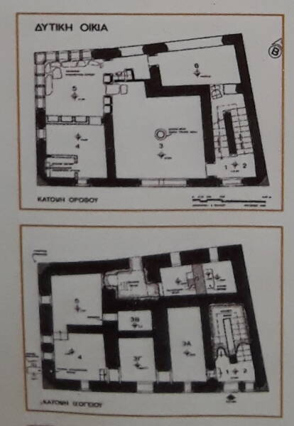
Here is a picture of one of the maps in the site, highlighting the Western House.
The same map had floor plans of the Western House. Below we see the first floor at top, and the ground floor below that. This is in the non-US nomenclature; the lower plan is of the lowest floor, the plan above that is of the floor above that.
The ground floor (bottom floor, bottom plan) contained food storage areas, workshops, a kitchen, and an area for milling grain.
The first floor (next floor up, top plan) had a large work area in room 3, with looms around a central column and illuminated by a large window. Room 5, in the western corner at upper right on the plan, contained several frescos now in the archaeology museum: two murals of fishermen, one of a young priestess, one of a river, and the famous miniature Frieze of the Fleet going around the top of all four walls.
Here you can see how Room 4, in the southern corner at the lower left of that floor's plan, had thin partitions dividing off a little less than a quarter of the space. That was the latrine. Room 4 also had the Ikria, the mural of the eight yachts, also in the archaeology museum now.
So, yes, the latrine was upstairs. But that would work fine with the Cycladic design of sanitary plumbing. This was no crude cesspit as was common in Europe through the 19th century CE. This latrine was connected into a terracotta drain line that ran down through the exterior wall to below ground level, where it connected into the municipal sewage line. A line from above could bring flushing water.
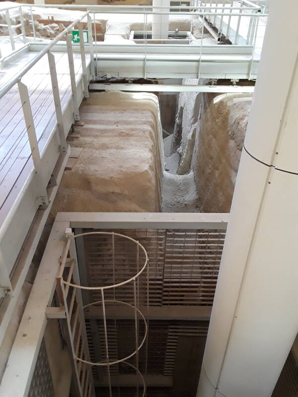
Here are views down into that space. We're roughly on the level of the second floor, looking into the first floor, and below that down into the ground floor. But where is the famous latrine? Do you see it?
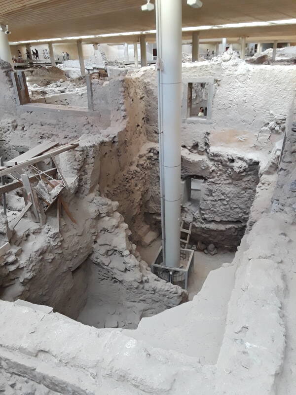
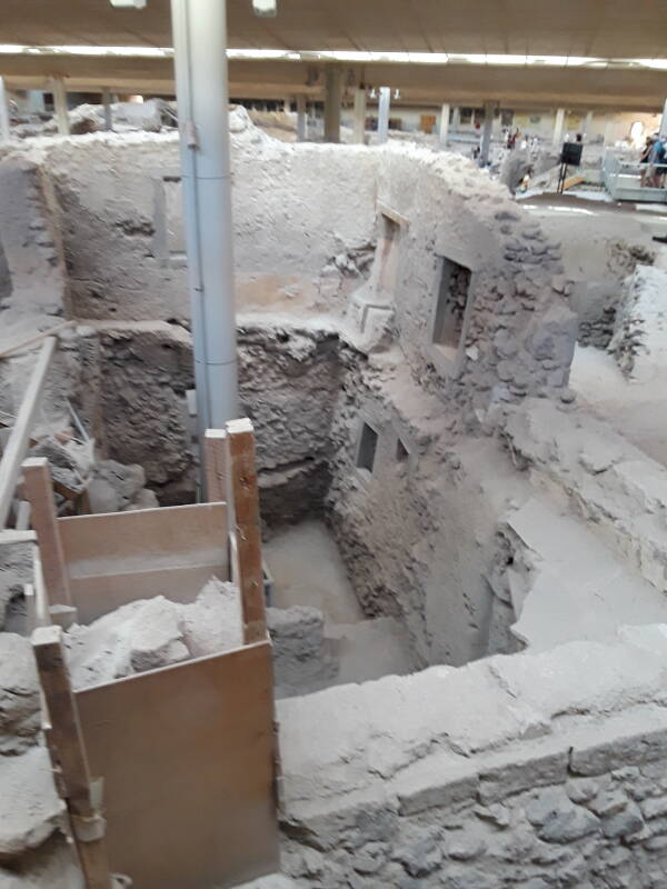
The latrine was in the far corner of the highest remaining level in the last picture above. The floor at that level would be based on beams resting on the ledge at the top of the walls of the ground level.
Learn Greekwith Duolingo
Thanks to Duolingo I was able to go to one of the
attendants and ask:
Με
συγχωρείς.
Η
τουαλέτα
σε
εκείνο
το
σπίτι.
Που
είναι;
Είναι
τώρα
στο
μουσείο
στα
Φηρά;
(Yes, Greek uses ";" as a question mark, by far the
worst part of an otherwise admirable orthography)
Excuse me.
The toilet in that house.
Where is it?
Is it now in the museum in Fira?
I was asking about the wooden toilet
seat,
not the entire latrine and the water supply and waste removal
networks into which it was connected.
But those distinctions were beyond the roughly first-semester
Greek level at which I was at the time.
Yes, she said. Ναί.
The seat is hidden away at the museum in the main town of Fira, but the latrine itself is still there. Let's take another look at the latrine location. It's at the far right corner.
The toilet seat extended back into a framed indentation in the southwest wall of Room 4A. In front of that indentation, at a comfortable seat height, a masonry block extends into the room. It has a vertical slot which is the toilet drain itself, connected to channels within the wall. There's more on that below.
Here is the area where the latrine had been, cropped out of the original of the above picture, then reduced to 50% original size. Then, in the second image, it has been histogram equalized.
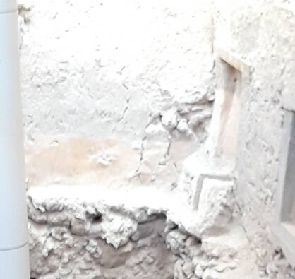
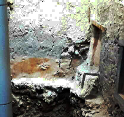
Notice the vertical slot of the toilet and its drain, black in the last image above. Below is another, better, view, also histogram equalized.
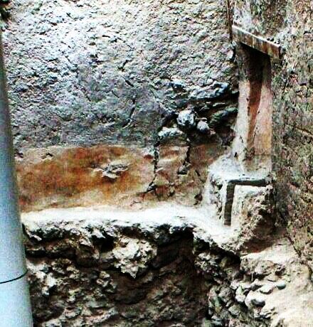
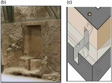
The above photo and diagram are from "History of sanitation and hygiene technologies in the Hellenic World", Stavros Yannopoulos et al, Journal of Water, Sanitation and Hygiene for Development, February 2017, DOI: 10.2166/washdev.2017.178. Notice that their paper references my page about Mycenaean toilets and drains. The diagram shows the flushing water supply coming from the seated user's right, the waste drain leading off to the user's left, and ventilation from above. They were able to get to a slightly better vantage point for their photograph.
I later visited the museum in Fira. There are some great things to see, including real frescos of that period, not just the speculative imaginings of Arthur Evans as you see at Knossos.
However, the famous latrine bench seat was not out on display when I was there.
Along the Caldera Rim
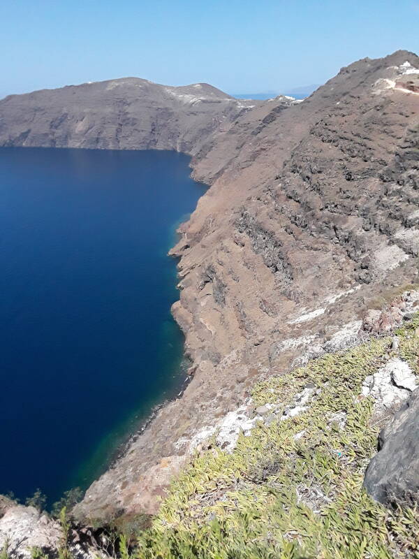
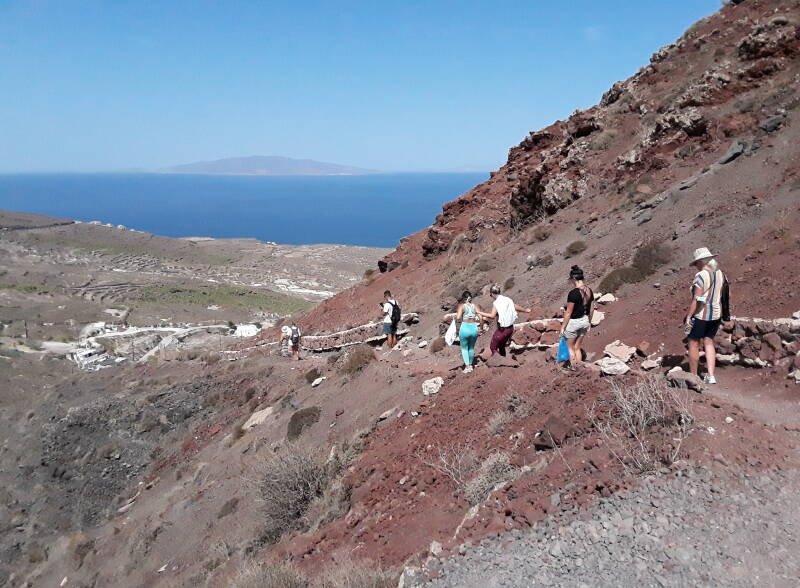
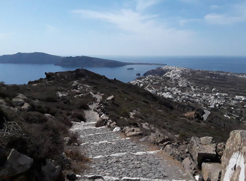
One day I walked along the caldera rim from Fira to Oia. The route was about 11 kilometers, with quite a bit of up and down.
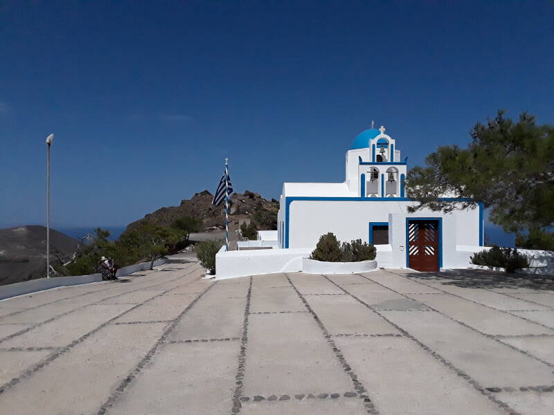
Along the way you come to Ναός Προφήτη Ηλία, the Church of the Prophet Elias. Chapels dedicated to Elias, commonly spelled Elijah in English, tend to be found on high points given the prophet's association with a mountain setting. And given that the Aegean islands are the peaks of mostly submerged mountains, except for Thira and Milos which are actually volcanos, there are many high points on which to build another chapel dedicated to Προφήτη Ηλία.
The Book of Kings describes Elijah's confrontation with King Ahab, the seventh king of the northern kingdom of Israel, and his wife Jezebel, daughter of the king of Tyre. Ahab built a temple to Ba'al, who was known as בעל to the Israelites, 𐎁𐎓𐎍 in Ugaritic cuneiform, 𐤋𐤏𐤁 in Phoenician, and Βάαλ to the later Greeks. Ba'al was a prominent deity of the ancient Levant.
Ahab also erected a pole for the worship of Ba'al's consort Astarte, a fertility goddess called Asherah in the Bible. Then he started fanatical religious persecution of the prophets of Yahweh.
Elijah, Priests of Ba'al and Asherah, and a Toilet DesecrationElijah organized a competition at the peak of Mount Carmel to show whether Yahweh or Ba'al was the stronger deity. Elijah was by himself against 450 prophets of Ba'al and 400 prophets of Asherah.
See the dedicated page for details of what happened, including the following retalitory shrine desecration involving an ancient toilet.
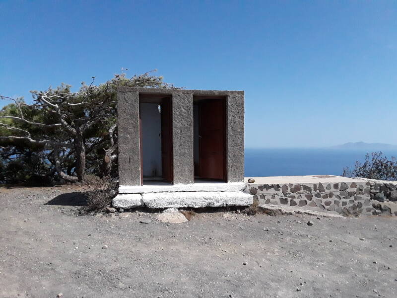
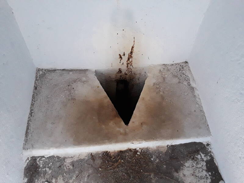
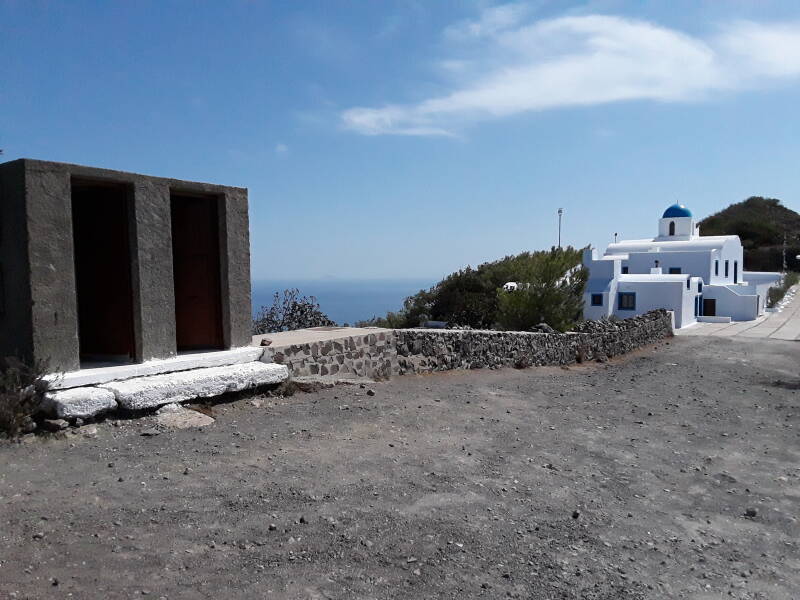
This church has a pair of squat toilets out in back.
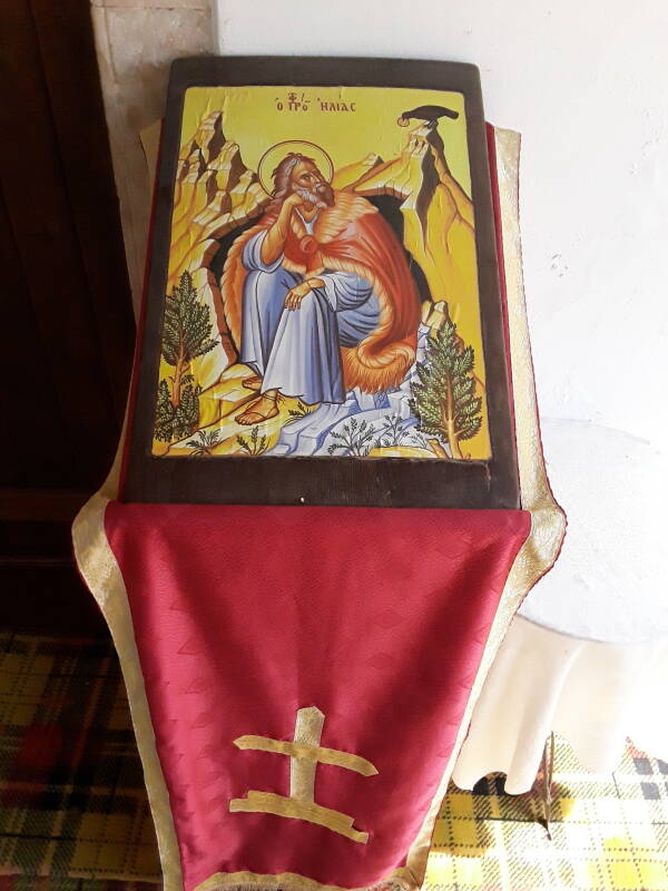
Elijah had won the competition, but Jezebel wanted him dead. He fled south to Judah, then on into the wilderness, and traveled forty days and nights to Mount Horeb, where Moses had received the Ten Commandments. Along the way he was fed by ravens. Below is an icon, a standardized representation of Elijah and a raven in the wilderness. This is in a different Church of the Prophet Elias.
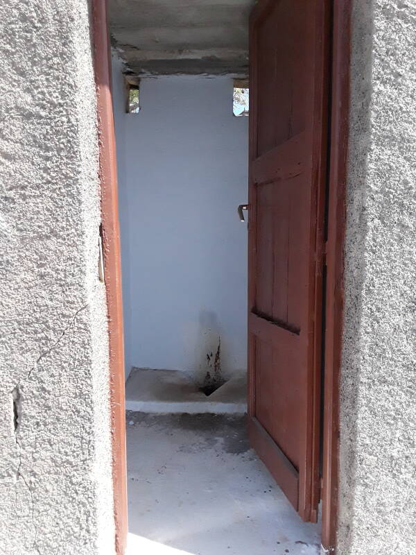
There's no flushing water, and no toilet brush to tidy up.
The Book of Malachi is the last of the Twelve Minor Prophets in the Hebrew Bible, it appears as the last book of the Old Testament in Christian Bibles. It describes how Elijah will return "before the great and awesome day of the Lord comes".
Toilets of theNew Testament
In the Christian New Testament, some think that John the Baptist is Elijah. Others think that Jesus is Elijah. Then Moses and Elijah appear with Jesus at his Transfiguration.
The Mormon church believes that Elijah returned on April 3rd, 1836, in Kirtland, Ohio, where he met with Joseph Smith and Oliver Crowdery, as described in Doctrine and Covenants, 110:13-16. Smith only had the King James Version of the Bible, which used the Hebrew transliteration "Elijah" in its Old Testament and the Greek "Elias" in its New Testament, leading to some confusion.
It's time to continue onward toward Oia.
The path is rough cobblestones at either end, in Fira and Oia, and volcanic gravel and dust in between. Here we're passing through a red layer of gravel and dust.
Approaching Oia at the north end, we transition back onto rough cobblestones. A ferry is moving through the pass between Oia at the northwest tip of Santorini and the smaller Thirasia island.
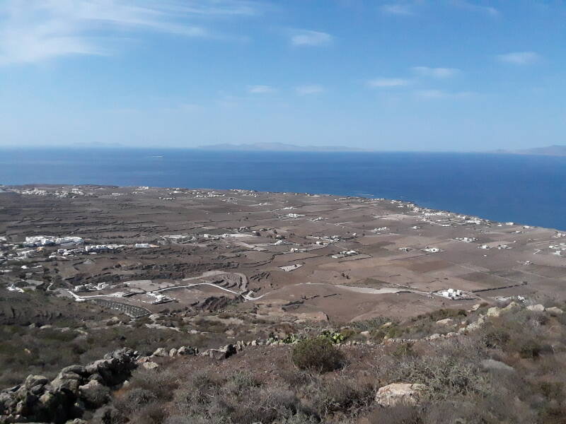
The land slopes down from the caldera rim to the outer shoreline. Much of it is busy with agriculture, with a unique terroir based on the largely tephra-based soil. Santorini is famous for its cherry tomatoes, and the Assyrtiko grapes. Those are used to make Athiri and Aidani white wines, and Mavrotragano and Mandilaria red wines. The Vinsanto is a sweet and strong dessert wine, a dark amber-orange wine made from sun-dried grapes and aged for a long time. The white wines are extremely dry with a strong citrus scent and mineral and iodide salt aromas contributed by the volcanic soil.
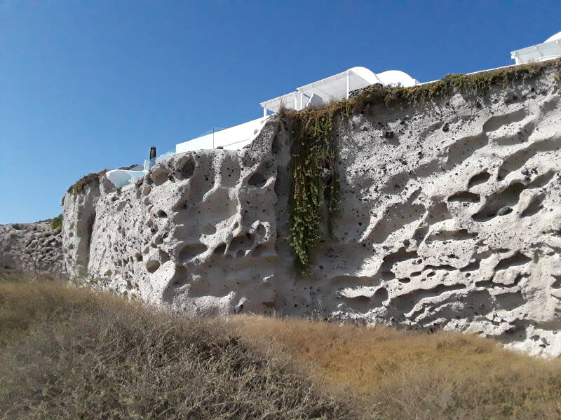
The local builders are quite confident in the strength of the tephra deposits. A resort is built on top of this vertical-sided deposit.
There is very little fresh water on Santorini, especially through the hot summer months when most visitors arrive. Average monthly precipitation in millimeters through the year is:
| Jan | Feb | Mar | Apr | May | Jun | Jul | Aug | Sep | Oct | Nov | Dec |
| 71 | 43 | 40 | 16 | 11 | 0 | 7 | 0 | 11 | 38 | 59 | 75 |
There is just one fresh water spring on Santorini, so the local people used to divert rain that fell on roofs and courtyards into underground cisterns. After an especially catastrophic earthquake in 1956, the cisterns fell into disuse. Through the 20th century, cargo ships had been bringing fresh water from other parts of Greece, and this became more crucial after 1956.
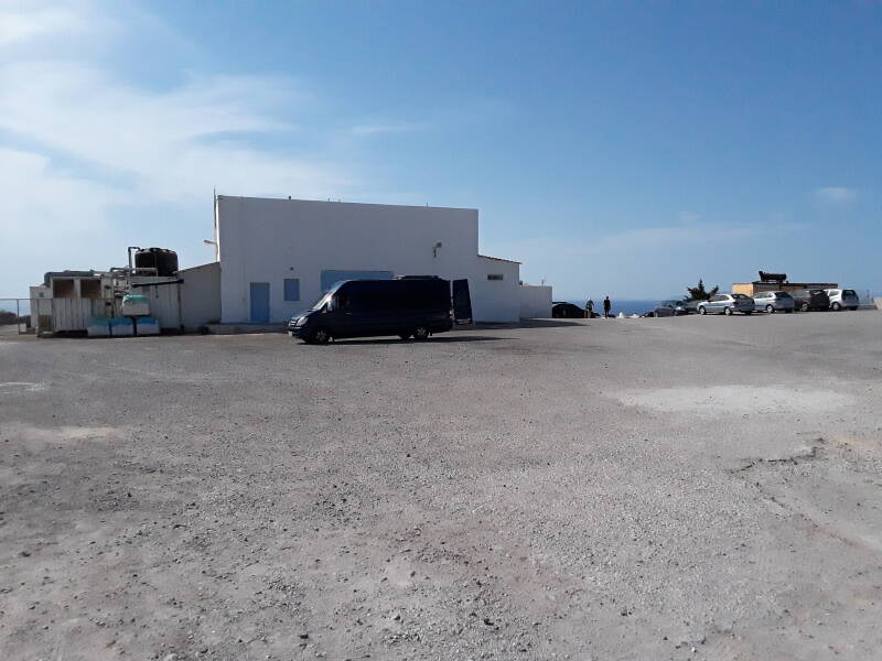
So, Santorini now relies heavily on local desalination plants. The first was built in Oia in 1992. By 2003 it had expanded to three desalination units, and by 2020 there were six, with a total capacity of 2,800 m3 per day. Here is the Oia desalination plant.
By October 2020, Mykonos, Naxos, and Paros were connected by 150 kV AC power cables, with 24 fiber optic lines integrated into each cable. They hoped to complete a 150 kV AC power connection between Crete and the Peloponnese by the end of 2021.
That's a backup diesel generator off to the right side. There is one power station in the eastern part of Santorini, with diesel engine and gas turbine powered generators with a capacity of 75 MW. The Cyclades Interconnection Project aims to connect Santorini by undersea power cable to Naxos and then on to the mainland by 2023.
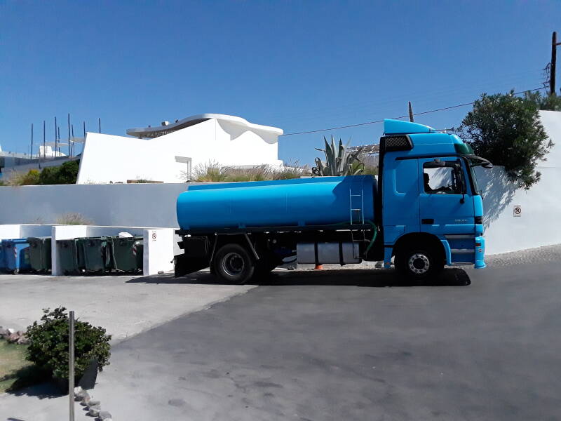
There is also a 5,000 m3/day desalination plant at Aghia Paraskevi, near the airport; a 1,200 m3/day plant at Fira; a 650 m3/day plant at Akrotiri; a 2,000 m3/day capacity plant supplying multiple communities; and two units on Thirasia with a total capacity of 350 m3 per day. DEYA Thiras or Δ.Ε.Υ.Α. Δήμου Θήρας operates the water supply and sewage treatment and garbage disposal on both Santorini and Thirasia islands.
And, you will see water supply trucks making their rounds, like this one.
The output of the desalination plants is, well, desalinated water, which is always an imperfect process. The locals simply tell you to not drink the tap water. That's a good idea. The tap water tastes pretty brackish. Buy bottled water. It's cheap in medium to large bottles at the grocery store.