Zagora
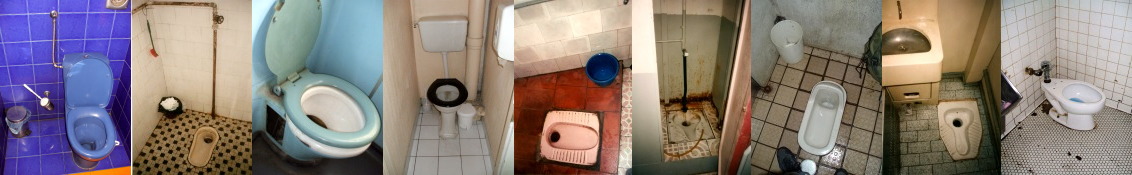
Zagora — Toilets of Morocco
VisitingZagora
From Marrakech I took a bus to Zagora,
a caravan town on the edge of the desert.
There was beautiful scenery going through the
Atlas Mountains.
Along the way we passed through Ouarzazate,
home to Morocco's booming film industry.
Beyond Ouarzazate we passed through Agdz,
at the upper right or northwest corner of the below map.
Then we continued east and southeast along the
Oued Drâa
or the Draa Wadi.
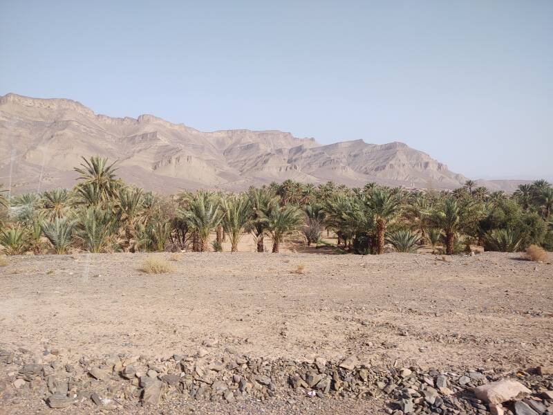
The Draa is Morocco's longest river, at 1,100 kilometres.
Most of it isn't a river as I think of one.
For much of it, there's no visible water at all.
It's a wadi,
a channel that carries some moisture.
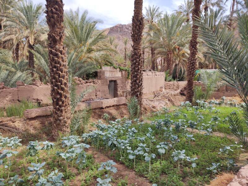
Its limited moisture irrigates date palm groves and small farms.
The Draa valley is Morocco's date farming center.
Fruit trees, vegetables, and henna are grown through here.
Khettara or qatarra,
irrigation tunnels known as
qanat far to the east,
have been used for irrigation for centuries.
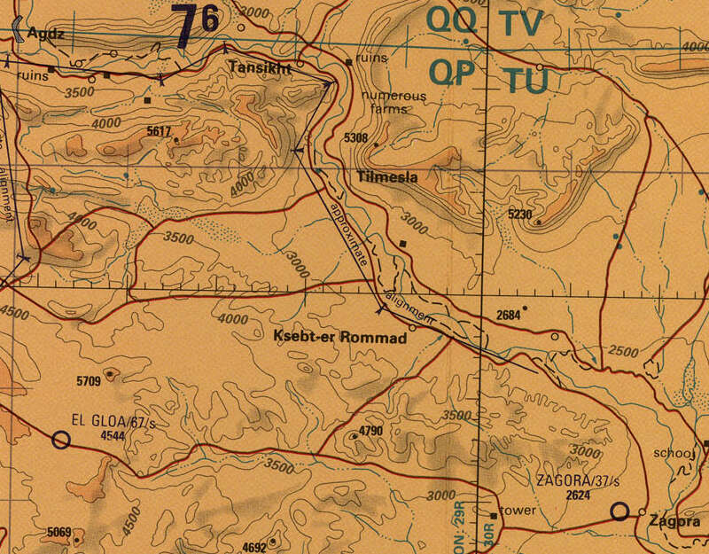
Small portion of 1:500,000 Tactical Pilotage Chart TPC H-2A from the Perry-Castañeda Library Map Collection at the University of Texas at Austin. Elevations are in feet.
Draa Wadi
Between Agdz and Zagora the road is mostly level, slowly descending as it continues along parallel to the Draa. Between Zagora and Agdz the wadi and highway pass between mesa-like highlands up to 2000 feet or 600 meters above the surrounding terrain.
The upper Draa wadi has six stretches of palm groves over two hundred kilometers, the first around Agdz, the third at Zagora, and the sixth at M'Hamid el Ghizlane at the end of the highway. This page shows toilets, other plumbing, and irrigation infrastructure around Zagora. The next page takes us to the end of the paved road and the town of M'Hamid el Ghizlane.
The water supply is dropping further every year. The "green zone" along the wadi has averaged about 3 kilometers wide but now it is shrinking.
The trains are fantastic in Morocco, and see the dedicated page for their on-board toilets and sinks. But they don't run further east from Marrakech. I had to continue by bus to reach Zagora and M'Hamid.
seat61.comThe Man in Seat 61 bases his on-line persona on what he sees as the ideal seat on the Eurostar train running through the Channel Tunnel on its way between London and continental Europe. I think that Seat 3 is the inter-city bus analogy for the idealized seat. Buying my bus tickets in advance, I was in Seat 3 in both directions between Marrakech and M'Hamid.
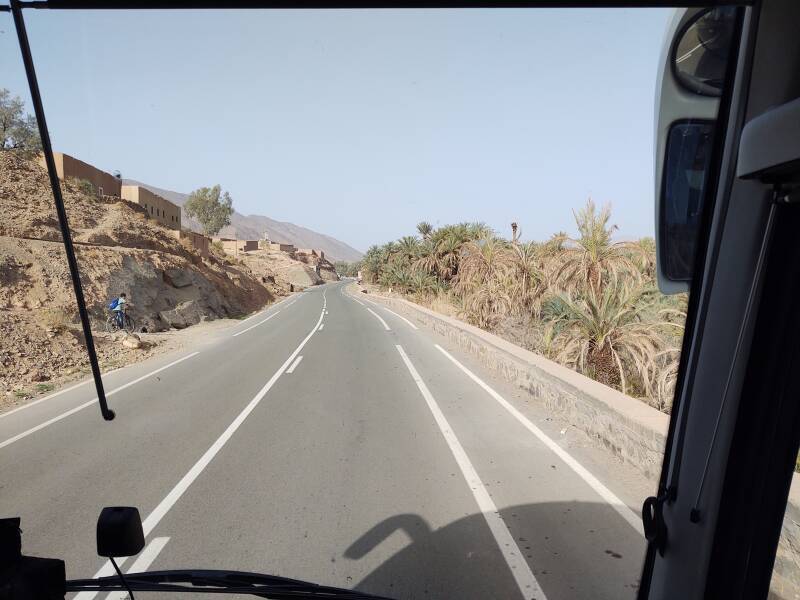
The pictures of the Draa wadi above are from my return to Marrakech. My trip to Zagora had left Marrakech around mid-day, at 12:45, and it had become dark by the time we arrived.
Guesthouses at Booking.comI had reserved a room through booking.com at the Karim Sahara guesthouse in Zagora. My room was just 225 Dirham per night, about US$ 21. Booking connects to Google Maps, and it includes a messaging feature with which you can communicate with the place you're staying. I had told my innkeeper that I would be arriving on the Supratours bus that arrived in the meeting. He met me at the bus stop when we arrived.
It was raining when I arrived — not mist, or a light drizzle, but actual hard rain. I was surprised by that, and asked if I had arrived during the rainy season. No. It had been eight years since it had rained like that in Zagora.
Exploring the town and its surroundings the next day, the only signs of the previous night's once-in-eight-years rain were muddy puddles in the morning, and a few small puddles in the bed of the Draa in the afternoon.
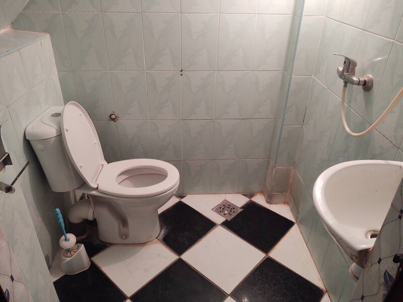
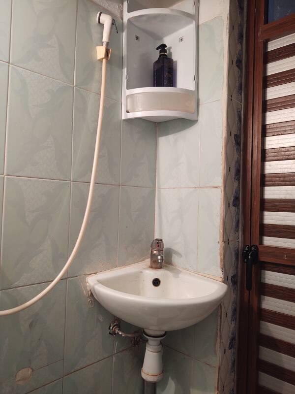
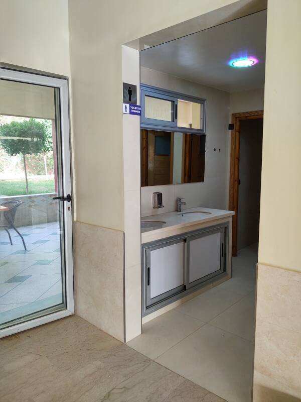
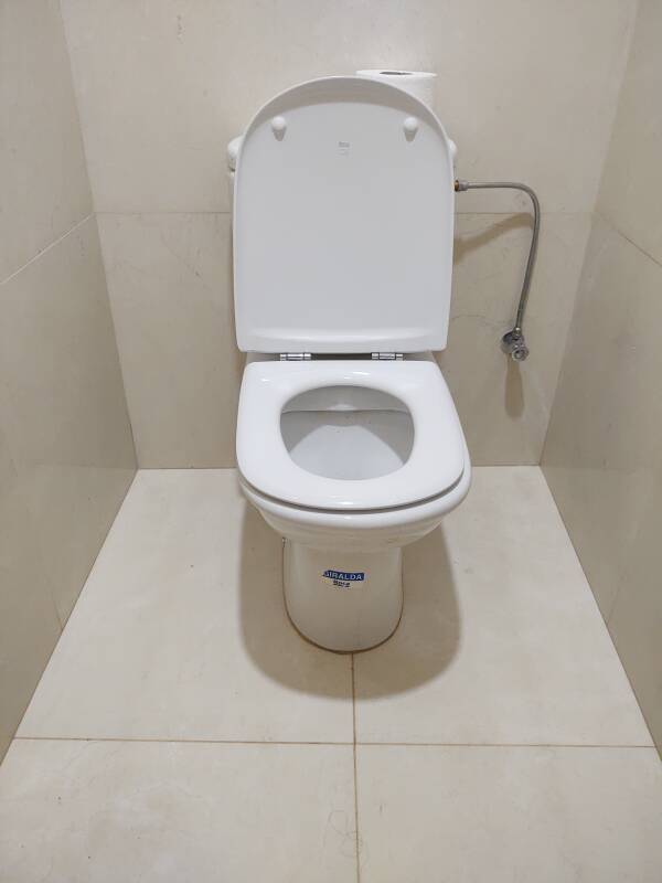
Meanwhile, you're getting anxious. What are the toilets like in Zagora? Very nice, in my experience. Here's a shared toilet and shower on my floor of the guesthouse. Check out the stylish vessel sink and the distinctively Moroccan zellij tilework around the sink.
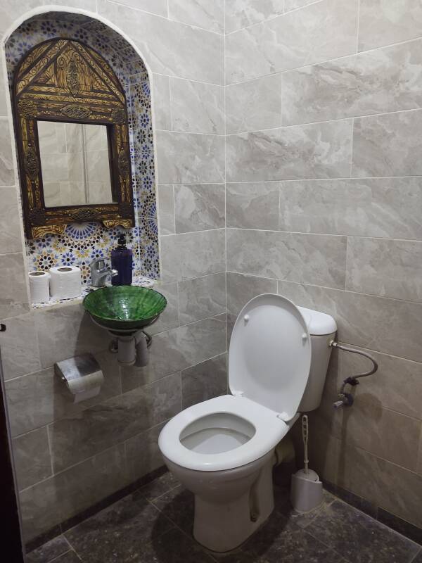
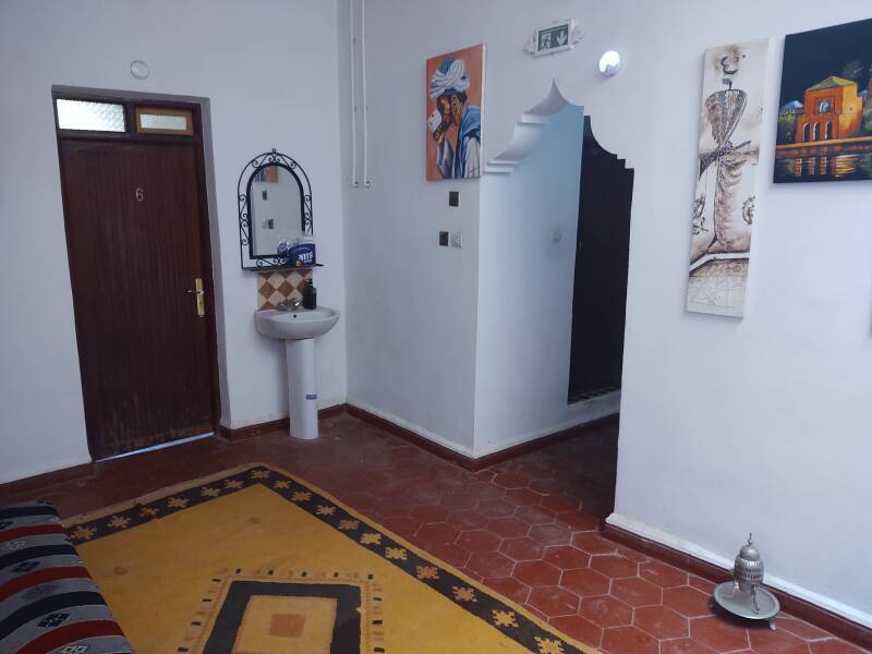
There was a sink in the shared lounge area outside my room, on the first floor up from ground level. Also notice the art on the walls, and the intricate shape of the doorway leading to the toilet and shower and on to the staircase. That's very typical of Morocco.
However, when I wanted a drink of water in the night, I got it out of the bottles I was carrying. The local groundwater was noticeably brackish.
My innkeeper had told me that in the 1990s you would almost always hit water when you drilled down only 10 meters along or close to the Draa wadi.
However, by 2022 you had to drill at least 100 meters to hit water, sometimes as deep as 200 meters, and sometimes not hitting any water even at that depth.
Climate change means hotter and drier conditions in Zagora and upstream. Increasing population and improving lifestyles in Zagora lead to much greater extraction. Water for cooking and drinking was carried in on trucks, as most groundwater had become too brackish.
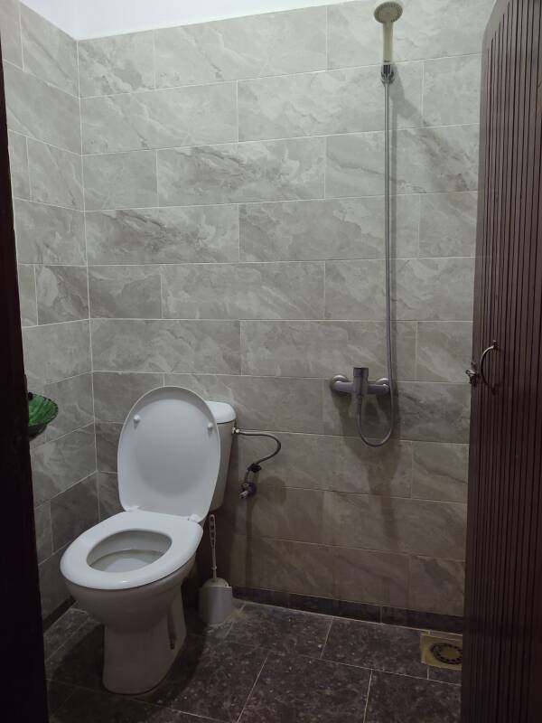
There was another shared bathroom downstairs, between the entrance and the large room where delicious breakfasts and dinners were served.
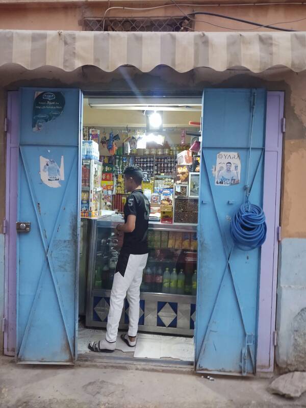
There was a small grocery store across the side street, down at the corner. They had a good supply of bottled water.
The room for breakfast, dinner, and relaxing in the evening had a large fountain built into one wall. It and the structural columns had elaborate zellij tile patterns.
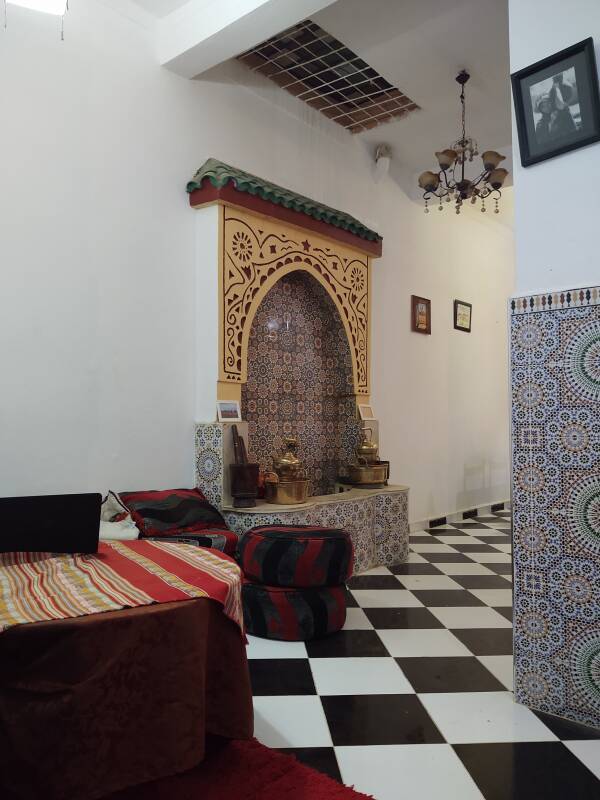
As usual in Morocco, this guesthouse was a riad, effectively a fort. A heavy metal door opened onto the street. My room had a window, but it opened into the lounge area, not to the exterior.
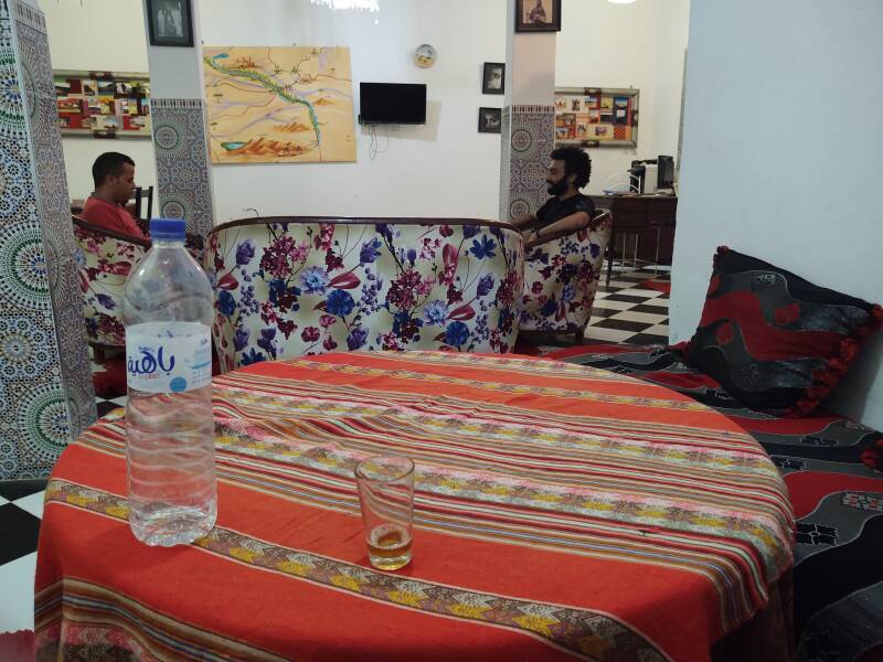
My innkeeper is at left, he is talking to his cousin, and I am drinking some water in the evening.
Irrigation
Zagora has been the jumping-off point for Sahara caravans for ages. It's the last town on the route from Marrakech to Timbuktu. Tradition says that Timbuktu is another 52 days across the desert from here.
VisitingZagora
It was toward the end of my trip to Morocco that I went into the desert to Zagora and then beyond there to M'Hamid el Ghizlane. As I had anticipated, and had planned for, by this time I wanted to relax and not maintain a full agenda every day. It was time to quit drinking from the firehose that is Moroccan history.
I discovered the Lonely Planet series of books in the early 1990s. Things have changed, and the Lonely Planet books are now aimed much more at luxury travel. However, not so much with the Morocco title.
My local public library had an almost current edition, the edition before the latest, and I had purchased a used copy of that through Amazon. I had also borrowed two other guide books from the library for my pre-trip planning.
Each of these purported references mentioned Zagora, and then went on to say that it didn't have much in the way of attractions.
That was actually what I was looking for. A pleasant place to relax with some interesting things to see.
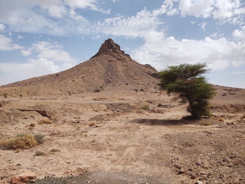
All of the books mentioned Jebel Zagora, a mountain that was a short (or medium, or longer yet) distance outside town. All of them described it as a tiring excursion and not really worth the trouble.
All of that simply encouraged me! I would stop in Zagora for a few nights on the way to M'Hamid, and I would check out this maligned geological feature. It was great!
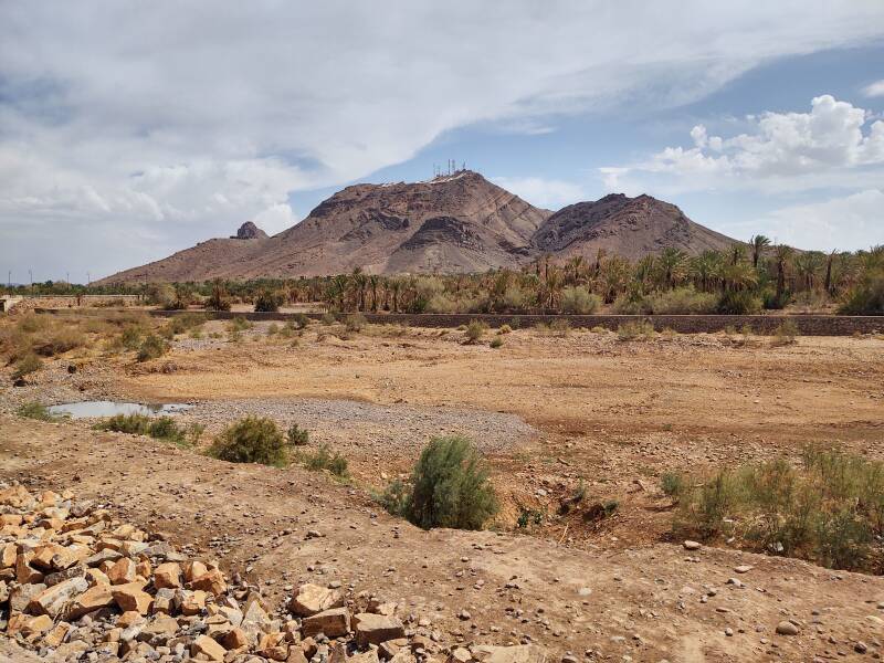
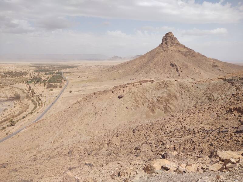
This 1956 1:250,000 U.S. Army Corps of Engineers map finally explained why the mountain's description was vague and inconsistent. Yes, that series of peaks — 971 meters closest to town, then 1030, 1006, 1024, and 1009 meters — is collectively Jebel Zagora, and then the 1028 meter peak at the far end gets its own name of Jebel Jellabia. All of them are volcanic plugs. The 971-meter peak housing a cluster of telecommunications gear was what the books were talking about. All of the peaks are 250 to 300 meters above the surrounding terrain.
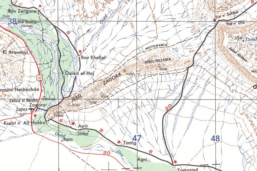
Small portion of 1:250,000 map H30-5 from the Perry-Castañeda Library Map Collection at the University of Texas at Austin.
Walking out of the south end of town, I came to the Draa wadi. There is a puddle from the previous night's rainstorm. Otherwise it's a dry channel. The westernmost peak with the radio installation is visible beyond the wadi.
Zagora grew up around one of the Draa's series of date palm oases. This area has some garden plots surrounded by irrigation channels.
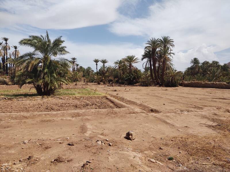
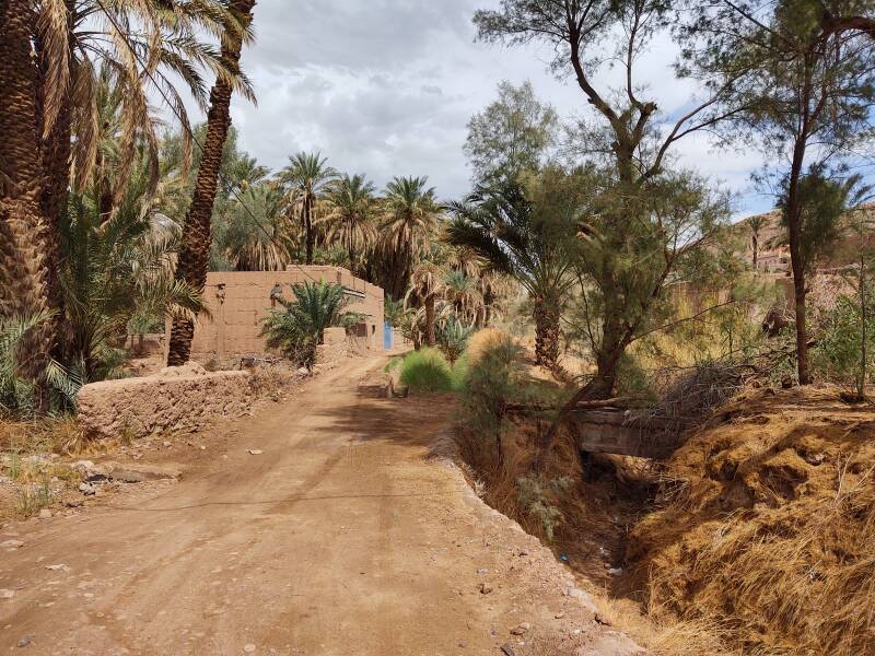
A concrete irrigation channel runs parallel to the road, upgraded from its designation as merely "motorable" in the 1956 map above.


Amazon 0593201892
Qanat is one of the many Arabic and Persian words that Frank Herbert used for his Dune books, although he refers to it as "an open canal" rather than a proper qanat or khettara.
Well, maybe there were open canals in the later books in the series, but not on the hyper-arid planet of Arrakis described in the original.
The second peak in the chain is more dramatic, obviously a volcanic plug.
Ascending the peak nearest town and looking back, I could see the irrigation channel leading away to the east-northeast, to the left and roughly parallel to the road.
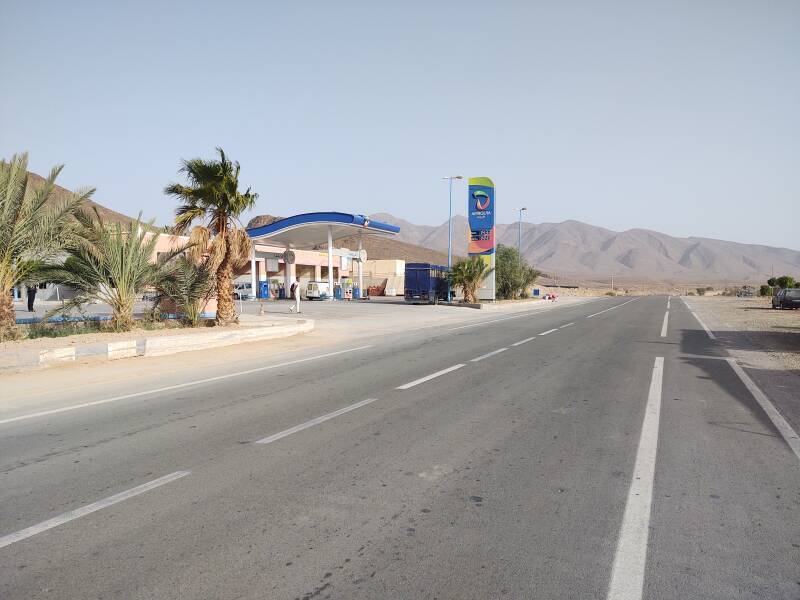
Bus Stop and Fuel Station
After continuing to M'Hamid and Erg Chigaga, several days later I passed back through Zagora on a bus. We stopped for fuel and a bathroom break about 50 kilometers north of Zagora, just about five kilometers before we reached Tamezmoute.
There's much more to see at Zagora, see my general travel page.
If you're following the pages in the order I visited places during my trip, the next stop is the town of M'Hamid el Ghizlane on the edge of the Sahara. Or, feel free to jump around: